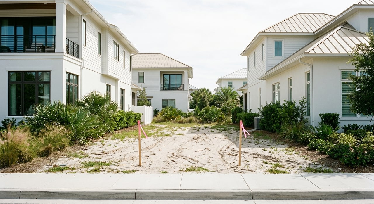
Looking for a small-lot opportunity in Inlet Beach? The challenge is that some of the best candidates do not stand out at first glance. A parcel can look simple on a map but turn complicated once you check the recorded plat, overlay rules, utilities, or flood requirements. In this guide, you will learn how to screen small-lot infill opportunities in Inlet Beach more carefully so you can spot potential earlier and avoid costly surprises. Let’s dive in.
Why Inlet Beach Infill Takes Extra Homework
Inlet Beach sits on the eastern edge of Walton County between the Gulf of Mexico and Lake Powell. According to the Inlet Beach Neighborhood Plan, the area was one of the first developed along the 30A corridor, is split by US 98, and must be reviewed under both the base zoning district and the neighborhood-plan overlay.
That matters because small-lot opportunities here are not always obvious vacant sites. In many cases, the better prospects are parcels where the lot history, overlay district, flood status, and utility service line up in a workable way. If you only look at a tax map or listing photos, you can miss the details that really control what is possible.
What Parcels Are Worth Screening
Neighborhood Infill Parcels
One of the clearest categories to watch is the Neighborhood Infill district. Walton County defines this as unplatted or vacant parcels totaling 10 contiguous acres or less in areas where most nearby land is already developed, with density ranging from 2 to 8 dwelling units per acre depending on compatibility with the surrounding area, as outlined in the Walton County Land Development Code.
For you, that means smaller parcels in built-up sections of Inlet Beach may deserve a closer look even if they seem easy to overlook. The key is not just size, but whether the parcel fits the county’s infill framework and surrounding development pattern.
Residential Preservation Lots
Residential Preservation parcels are another important category. Walton County states that this district generally applies to subdivisions existing as of November 7, 1996, approved vested projects, or recorded platted subdivisions with infrastructure in place and substantial buildout, with density typically limited to one dwelling unit per platted lot under the approved plat or development order.
These parcels can still be valuable, but they often come with tighter limits. If you are hoping to rework lot lines or increase yield, this is an area where assumptions can get expensive.
Corridor and Village-Area Lots
Some corridor and village-center sites may support live-work or neighborhood-commercial concepts if the parcel location and design fit the overlay. The Inlet Beach Neighborhood Plan allows certain live-work and neighborhood-commercial patterns in designated areas, while also requiring a residential character, favoring side or rear parking, and applying frontage and sidewalk standards.
If your strategy includes mixed-use potential, this can open another lane beyond a standard homesite. Still, the design rules are part of the opportunity, not an afterthought.
Why Utility Access Changes The Math
A lot may look promising until you verify utility service. South of US 98, the Inlet Beach plan limits maximum residential density to 4 units per acre with central water and sewer, 3 units per acre with central water only, and allows select parcels identified for higher density to reach 8 dwelling units per acre, according to the neighborhood plan.
That means utility availability can directly affect value and intended use. Before you price a deal as a build, split, or hold opportunity, confirm whether the site has the service level needed to support your plan.
How To Research A Parcel Before An Offer
Start With County Map Tools
Walton County offers several mapping tools that can help you screen a parcel quickly. The county’s Planning Interactive Map page explains that its general map includes addresses, parcels, future land use, wetlands, and flood zones, while the planning map adds beach mouse tiers, elevation contours, and other planning layers. The project review map also shows current and pending development projects along with hazard and planning overlays.
This is the best starting point for a first-pass review. You can use these tools to narrow down parcels that deserve deeper due diligence before you spend money on surveys, legal review, or engineering.
Verify The Legal Lot
Do not stop at the parcel outline. Walton County’s Plats and Replats page explains that a recorded plat is reviewed and accepted into the public record, and that a property appraiser map may differ from the actual lot configuration.
In simple terms, the lot you think you are buying may not function the way the parcel layer suggests. For small-lot infill, that difference can shape setbacks, access, and whether the site is truly buildable as expected.
Pull Deeds, Easements, And Restrictions
The next step is document work. The Walton Clerk Official Records portal is where you can search recorded deeds, official records, and other documents that often reveal easements, restrictions, and subdivision history.
This is where hidden issues often show up. Utility easements, private restrictions, old subdivision documents, or lien-related records can all change the risk profile of a parcel.
Overlay Rules Matter More Than Many Buyers Expect
Inlet Beach is not governed by base zoning alone. The neighborhood plan makes clear that development must comply with both the underlying zoning and the overlay framework, which includes standards intended to preserve neighborhood character and guide frontage, parking, and compatibility.
That is why a lot can appear buildable in a broad sense but still face meaningful design constraints. Rear or side parking may be preferred, sidewalks may be required for certain development types, and height and compatibility standards can affect how a project is designed.
Flood And Coastal Constraints Can Make Or Break A Deal
Check Flood Zone Early
Flood status is one of the first items to verify in Inlet Beach. Walton County states on its Flood Plain Management page that South Walton County’s current Flood Insurance Rate Map became effective on December 30, 2020, and that the county participates in FEMA’s Community Rating System at Class 6, which provides a 20 percent discount on flood insurance policies for properties in Special Flood Hazard Areas.
The county also notes it can provide flood-zone determinations, usually within one business day. That makes flood verification an early, practical step instead of something to leave until late in the process.
Understand Elevation Requirements
If a parcel is in a flood hazard area, building rules can materially affect project cost and design. Walton County’s building requirements for flood hazard areas state that new construction in AE zones must have the finished floor at least 1 foot above base flood elevation, while VE and Coastal A zones require the lowest structural member to be at least 1 foot above BFE.
Those are not minor details. Elevation requirements can affect foundation type, stairs, parking layout, and construction budget from the start.
Watch For Coastal Permitting Issues
Beachside parcels may face an added layer of state review. The Florida Department of Environmental Protection explains that the Coastal Construction Control Line program regulates construction seaward of the CCCL, and in sandy beach areas without an established CCCL, coastal construction is generally prohibited within 50 feet of mean high water unless a waiver or variance applies.
DEP also notes that permitting decisions consider impacts to dunes, native vegetation, and marine turtles. For a near-beach lot, this can be one of the most important early checks.
Red Flags To Catch Before You Commit
A few issues come up again and again with small-lot infill in Inlet Beach:
- Relying on GIS alone instead of comparing it with the recorded plat and deed
- Assuming an older lot can be split or reconfigured without confirming lot-of-record status or subdivision limits
- Skipping utility letters even though service availability can affect allowed density
- Overlooking overlay design standards for parking, sidewalks, frontage, and compatibility
- Assuming a small project avoids review when county thresholds may still trigger planning review
Walton County’s development review threshold criteria make clear that even smaller proposals may still go through formal planning paths, depending on scope. And the county’s building permit review process states that Planning and Development Services reviews single-family homes, pools, and many accessory structures for land development code compliance before building permits are issued.
A Practical Due-Diligence Sequence
If you find a promising parcel, this is a smart order of operations based on Walton County’s process:
- Review the parcel using the county mapping tools for future land use, zoning, wetlands, flood zones, and planning layers.
- Compare the parcel map with the recorded deed and plat.
- Confirm whether the site falls within Neighborhood Infill, Residential Preservation, Village Mixed Use, or another relevant district.
- Verify flood requirements, possible coastal permitting exposure, and utility availability.
- If your plan depends on a split or replat, start the county pre-application process early.
Walton County’s lot split application package shows how detailed that process can be. Required items can include proof of ownership, title search, flood-zone map, zoning map, utility availability letters, surveys, HOA authorization if applicable, and an environmental assessment when wetlands are present.
What The Best Opportunities Usually Have In Common
In Inlet Beach, the best small-lot infill opportunities are often not the most obvious ones. They are usually the parcels where the recorded lot history is clean, the overlay district supports the intended use, utility service is available, and flood or coastal constraints are manageable.
That is why local knowledge and methodical screening matter. If you are looking at infill lots, redevelopment candidates, or land with long-term upside in Inlet Beach, working through the county framework early can help you move with more confidence and fewer surprises.
If you want a second set of eyes on an Inlet Beach lot or need help evaluating land and development opportunities along 30A, connect with Erich Hardy. You will get local insight, responsive guidance, and a practical approach built for both lifestyle buyers and investors.
FAQs
What makes a small-lot infill parcel in Inlet Beach worth a closer look?
- A promising parcel usually has recorded lot history that checks out, overlay rules that support the intended use, utility access that matches density goals, and manageable flood or coastal constraints.
Why do overlay rules matter for Inlet Beach lot opportunities?
- Inlet Beach development is reviewed under both base zoning and the neighborhood-plan overlay, so a lot may appear usable on paper but still face design, parking, frontage, sidewalk, or compatibility requirements.
How can you verify whether an Inlet Beach parcel is legally configured the way it appears online?
- Compare the property appraiser parcel map with the recorded plat, deed, and official records, since Walton County notes that parcel mapping may differ from the actual legal lot configuration.
What flood issues should you check before buying an Inlet Beach infill lot?
- You should confirm the flood zone, elevation requirements, and whether the parcel falls in a special flood hazard area, since those factors can affect design, construction cost, and insurance.
When should you start the lot split or replat process for an Inlet Beach property?
- Start early, especially if your deal depends on changing lot lines, because Walton County requires a pre-application conference and a detailed submittal package for lot splits and similar requests.